

Annonse
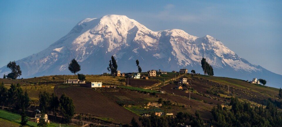
Norway sits atop a strange and ancient part of the Earth's crust
Cratons have puzzled geologists for a long time.

Published
These are the Earth's primordial rocks.
- In areas like eastern Finnmark, Lofoten, and Vesterålen, the bedrock is as old as 3 billion years.
- Parts of eastern Norway, Trøndelag, western Norway, Telemark, and Agder also rest on bedrock between 1 and 1.5 billion years old.
The explanation is that Norway sits atop a very ancient craton.
But cratons have long been a mystery to geologists.
Researcher Jyotirmoy Paul at the University of Oslo may now have come closer to an answer.
Annonse
Beginning to understand

The word craton comes from the Greek κράτος, meaning strength.
Norway is situated on top of one of these cratons. It is called the Baltic Craton or the Baltic Shield. This craton is especially unusual in nearby regions like northern Finland, Sweden, and parts of Norway.
"Cratons are extremely old. The oldest can be nearly 4 billion years old and are found in places like Greenland and Canada," says Trond Helge Torsvik.
He is a geodynamicist, and leads the University of Oslo's Centre for Planetary Habitability (PHAB).

A 'black hole' in geology
"Cratons have long been a 'black hole' in geology," Torsvik tells Science Norway. "It's still partly a mystery how these cratons formed and why they've lasted so long."
- The Earth's crust – both on land and the seabed – is constantly changing. Much of the Earth's crust is only a few hundred million years old.
- The seabed beneath the world's oceans is even younger, averaging just 70 to 100 million years old.
But in certain places on Earth, there are ancient cratons. Like those beneath Norway, Sweden, and Finland.
These are strange geological regions that have survived for an incredibly long time. Without being destroyed by geodynamic processes in the Earth's crust or the slowly flowing mantle beneath it.
Watch the short video below where researcher Jyotirmoy Paul shows how the Earth's cratons have survived the past 400 million years. Cratons are light and have drifted around like floating 'corks' on top of the Earth's mantle. The rest of the Earth's surface and seabed has often been completely transformed in just a few hundred million years. (From Paul and Gosh, 2020)
Gold, diamonds, and iron
Cratons are often rich in mineral resources such as gold, diamonds, and iron.
- Finland is Europe's largest gold producer. It is also among the ten largest mineral producers in the world.
- Gold has also been extracted from the Finnmarksvidda plateau in Norway for over a hundred years.
- Sweden accounts for 90 per cent of Europe's iron ore production. In Kirkenes, Norway, lies Europe's third-largest iron ore mine.
Annonse
The fact that Finland, Sweden, and Norway sit atop a very old craton is a major reason why these countries are so rich in minerals that became part of the Earth already when it was formed.
In northern Finland, rock has been found that is 3,730 million years old. That is almost as old as the world's oldest rock, just over 4 billion years, discovered in the Slave Craton in Canada.
As you may know, our Earth is just over 4.5 billion years old.
The oldest on Earth
Jyotirmoy Paul explains that cratons are both the oldest and the most stable parts of what geologists call the lithosphere – the Earth's crust and the upper part of the mantle.
'Litos' is the Greek word for stone. And the lithosphere is the solid outermost layer of the Earth.
The Earth's crust is divided into several large and small plates – the tectonic plates – that move relative to one another.
"Cratons have survived billions of years of geological upheaval in the lithosphere," says Paul.
The question is: What has made them so resilient?

A combination of viscosity and thickness
Paul and his colleagues have conducted studies concluding that a special combination of viscosity and thickness makes cratons especially strong.
This protects them from being destroyed or reshaped by the Earth's internal forces.
Most viewed
The Earth's crust is, on average, only about 10 kilometres thick. But beneath cratons, it is often 20 kilometres thick – and sometimes much more. That's at least twice as thick as elsewhere on the land surface.
Under the oceans, the crust is thinner, averaging just 7 kilometres.
In the middle of the North Sea, the thickness of the Earth's crust can be as little as 4 kilometres.
In comparison, under parts of the Baltic Craton in Finland and northern Sweden – not very far from the North Sea – the thickness can reach an extreme 150-250 kilometres.
"When cratons are both thick and viscous, it creates a kind of internal self-compression. This prevents them from breaking apart into smaller pieces," says Jyotirmoy Paul.
The Baltic Craton, the Caledonian mountain range, and the Oslo Rift
The craton beneath Norway is known as the Baltic Craton. It stretches eastward from Norway and into Russia.
Norway is geologically quite special.

- One reason is the craton the country sits on.
- There is also the long-gone Caledonian mountain range, which shaped much of the Norwegian landscape. Around 425 million years ago, the continental plate that Greenland lies on was pushed all the way to Norway. The pressure was so intense that it formed a mountain range that may have had the tallest peaks on Earth, up to 10,000 metres (link in Norwegian). The highest peaks were likely located where Møre is today, in western Norway. Much of the country still bears the marks of this massive Caledonian collision.
- Just under 300 million years ago, something equally spectacular happened. The complex Oslo Rift was formed. A rift tore open the Earth's crust. Lava and volcanoes emerged. But the process stopped, and the remnains of the rift today stretch from Vestfold up to Lake Mjøsa, along the western side of the Oslofjord.
The stone you pick up from the ground
Despite the Oslo Rift and the Caledonian mountain range, much of Norway lies directly atop what people often refer to as the basement rock.
The ancient craton.
In Finnmark, Troms, Nordland, Trøndelag, western Norway, and southern Norway – especially in areas like Telemark, Agder, and parts of eastern Norway – the basement rock is exposed.
Here, the bedrock consists largely of hard gneiss and granite.
If you go out and pick up a stone from the ground in one of these places, it could easily be more than a billion years old. Possibly much older.

By comparison, Mount Everest in the Himalayas only began forming around 50 million years ago.
———
Translated by Alette Bjordal Gjellesvik
Read the Norwegian version of this article on forskning.no
References:
Paul, J. Cratons, Why Are You Still Here?, Eos, 2021.
Nordgulen, Ø. & Andresen, A. De eldste bergartene dannes (The oldest rocks are formed). In Ramberg et al. (Eds.), 'Landet blir til' (The land is formed), Norwegian Geological Society, 2006.
NRK article about Sydvaranger mine (link in Norwegian), 2024.
Related content:

Subscribe to our newsletter
The latest news from Science Norway, sent twice a week and completely free.


