Annonse
Opinion:
Who should collect, manage and have access to data from the oceans?
OPINION: Research institutions from Norway and other countries have collected a great amount of data from the northern oceans in recent years. Many people want access to this information.
Those who hold such data and know how to use it will have a lot of power in terms of value creation, management and security. New technology will significantly increase the flow of data, and an as yet unresolved question is how this information should best be managed.
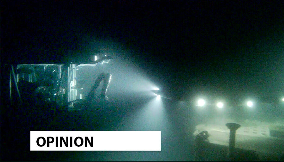
Together with partners, the research community at NTNU’s Centre for Autonomous Marine Operations and Systems (AMOS) has developed methods and technology that can monitor large areas of ocean in the High North.
The world’s largest tele-microscope, from space to the ocean bottom
This technology consists of robots and unmanned vehicles for use under water and on the sea surface, as well as small satellites and unmanned aircraft. Among other things, the vehicles are equipped with acoustic and optical sensors, such as hyperspectral cameras.
We question who should own, quality assure, make available, and manage the large volumes of data collected through research, management and industry.
By combining all these technologies, the conditions and changes in the ocean can be observed over areas ranging from a few centimetres to thousands of square kilometres – and over time periods ranging from seconds to decades. Together, this forms an observation pyramid that can collect enormous amounts of data.
Annonse
These data provide important information about climate change, biodiversity and health status in the oceans, as well as on human activity and vessels in the ocean areas. In addition, this type of data may also be of great military, strategic and geopolitical relevance.
Race for the High North
A warmer climate means that the High North will become even more important in the years to come. It is a place that gives clear indications of the planet’s state of health. With ice-free seas in the north, we are on our way from a white to a blue Arctic Ocean, where we will see increased human activity, a high probability of biodiversity loss, possible changes in ocean circulation and acceleration of global warming.
We are also seeing changes in the commercial value of the area and in geopolitical interest. Presence, knowledge and cooperation between allies will be crucial for asserting sovereignty and control in the increasingly large areas of ocean that are becoming ice-free.
Democratization of the oceans and outer space
In line with rapid developments in information and communication technology, the observation pyramid can be expanded and adapted faster at far lower costs than traditional ship, aircraft and satellite-based solutions.
In most cases, it also has a lower carbon footprint than the conventional solutions.
Because lower costs make the technology available to more people, we can call it a ‘democratisation’ of the oceans, airspace and outer space, where new actors can get involved. Unfortunately, increased accessibility also leads to increased vulnerability to sabotage of offshore infrastructure – a threat that needs to be dealt with.
Amazon and Google are on the scene
Many actors are interested in access to information about ocean areas. We question who should own, quality assure, make available, and manage the large volumes of data collected through research, management and industry.
The EU is working to create digital twins of the ocean with help from ESA Digital Twin Earth, Emodnet and projects such as Illiad. The owners of the world’s largest technology companies such as Amazon, the Bezos Earth Fund and Google are also interested in ocean data. Google Earth Outreach already collects and presents data on fisheries.
In Norway, HUB Ocean and REV Ocean are working to establish a global centre for ocean data.
As far as possible, ocean data must also be shared globally, something that is already being done by the EU, ESA and NASA.
As a leading maritime nation, Norway must take responsibility
Annonse
We believe that the Norwegian authorities must take responsibility and increase their level of ambition regarding presence and ocean data in order to ensure sound management of resources and value creation based on these data. We should not wait for foreign actors to do the work for us while we take a back seat.
Mobilisation for more systematic collection and management of ocean data should take place through international collaboration between public and private actors.
The investment in the Norwegian Ocean Technology Centre and Fjordlab in Trondheim is an important step in developing national capacity for ocean data collection, both in terms of monitoring the oceans, and also enabling Norwegian industry to develop the technology that will be needed.
The Norwegian Ocean Technology Centre should be supported by the establishment of national research infrastructure for small satellites, drones and autonomous vehicles. An important part of this investment will be the realisation of a national strategy for ocean data.
Such a strategy needs to be put in place quickly, especially in the current situation of heightened geopolitical tension, climate change and nature crises. An international race is taking place involving critical offshore infrastructure and important marine resources that Norway cannot afford to lose.
A live website for ocean data
Another aspect of research data is that it generally takes a long time to analyse and make them available as a basis for decision-making in near real time. For authorities, researchers and industry working on issues related to the ocean, it is important to gain access to new data as quickly as possible, not least data that provide information about changes in the climate and biodiversity and activities taking place at sea.
We want to mobilize the nation to create a website similar to the live weather website yr.no, with real-time data on what is happening in the oceans – a central website that can provide immediate information and weather forecasts about oceanographic conditions such as currents, temperature, salinity, oxygen content and algal blooms. NTNU is ready to contribute with interdisciplinary teams of experts.
(The opinion was first published at gemini.no)
Share your science or have an opinion in the Researchers' zone
The ScienceNorway Researchers' zone consists of opinions, blogs and popular science pieces written by researchers and scientists from or based in Norway. Want to contribute? Send us an email!


